Kanatal at a Glance: Perched at an elevation of approximately 2,590 metres (roughly 8,500 feet) on the mountain crest connecting Mussoorie and Chamba in Uttarakhand’s Tehri Garhwal district, Kanatal stands nearly 600 metres higher than Mussoorie and far above crowded commercial hill station corridors. This pronounced altitude delivers crisp alpine air, summer daytime temperatures that rarely exceed 24°C, and vivid panoramic vistas across the Garhwal snowline—including Bandarpunch, Swargarohini, and Chaukhamba—on clear mornings. Highlights include the tranquil, gently graded trails of Kaudia Forest (a dense deodar cedar and ban oak sanctuary 3 to 5 km away), the sacred high-altitude summit of Surkanda Devi Temple (2,750 m, reached via a steep 1.5–2.5 km hike or a modern 5-minute passenger cable car from Kaddukhal), and unhurried hillside stays. Accessible from Delhi NCR (~310 km) via the smooth, all-weather Chamba highway that bypasses Mussoorie town traffic entirely, Kanatal is ideal for travellers seeking genuine mountain solitude, cool breezes, and forest walks.
Across the middle Himalayas of northern India, the quest for mountain peace has become increasingly complicated. In celebrated colonial hill stations like Mussoorie, Shimla, and Nainital, peak-season travel often means navigating dense urban traffic, crowded commercial promenades, and saturated parking facilities. Yet just a few ridgelines beyond the bustling hubs of Uttarakhand lies a very different mountain landscape—one where high-elevation winds whisper continuously through ancient Himalayan cedars, where valley morning mist gives way to jagged, snow-capped horizons, and where days unfold to the unhurried rhythms of village footpaths and birdsong.
This is Kanatal. Situated on the high watershed crest of the Tehri Garhwal district at roughly 2,590 metres (8,500 feet) above sea level, Kanatal is one of the highest road-accessible hill settlements in the state. Unlike destination towns built around congested lakefronts or colonial shopping malls, Kanatal is essentially an expansive, open mountain ridge. Here, narrow ribbon settlements, terraced apple orchards, and secluded forest clearings look out over sweeping 180-degree valleys that plunge down toward the Bhagirathi river basin on one side and the Aglar valley on the other.
Whether you are planning a cool summer escape from the oppressive heat of the northern plains, looking for peaceful curated destination stays in Kanatal, or seeking an unhurried base for deodar forest walks and high-altitude photography, this comprehensive destination guide explains what to realistically expect from Kanatal and how to plan an effortless mountain journey.
The High-Altitude Ridge Geography: Elevation, Climate & Setting
To understand what makes Kanatal unique, one must examine its elevation. Sitting at approximately 2,590 metres (8,500 feet), Kanatal towers significantly above its regional neighbours. Mussoorie’s Mall Road rests at approximately 2,000 metres; the transit gateway of Chamba sits down at 1,600 metres; and the foothill capital of Dehradun lies at just 650 metres in the Doon Valley. Even Dhanaulti, located about 12 to 15 kilometres to the west, sits slightly lower along the same undulating mountain spine.
This elevation differential creates an immediate microclimatic shift. When daytime temperatures in the northern plains surge beyond 40°C in May and June, and even foothill valleys experience humid warmth, Kanatal enjoys brisk daytime temperatures averaging between 15°C and 24°C, dropping to a cool 12°C to 15°C after sundown. In autumn and winter, the thin, clean mountain air turns sharp and crystalline, producing sub-zero overnight temperatures and frequent snowfall events between late December and mid-February.
The name Kanatal itself carries an intriguing historical etymology. Derived from the Garhwali words *Kaa-na Tal*—meaning “blind lake” or “dry tarn”—the name recalls a natural mountain pond that historically gathered in a shallow hollow on the ridge before silting and draining naturally several generations ago. Today, no standing lake exists in the village; instead, the open high-altitude meadows and pine-clad hillsides that surround the historic site provide visitors with expansive valley views rather than enclosed water vistas.
Because the settlement is distributed linearly along the Chamba-Mussoorie highway and adjacent hillside spurs, Kanatal has no centralized “town square” or noisy commercial marketplace. Instead of neon signboards and crowded souvenir stalls, the landscape is defined by terraced mountain slopes, stands of Himalayan chir pine (*Pinus roxburghii*) and ban oak (*Quercus leucotrichophora*), small stone homesteads, and panoramic viewpoints overlooking distant agricultural hamlets.
The Panorama Reality: Garhwal Snow Peaks & Clear-Sky Timing
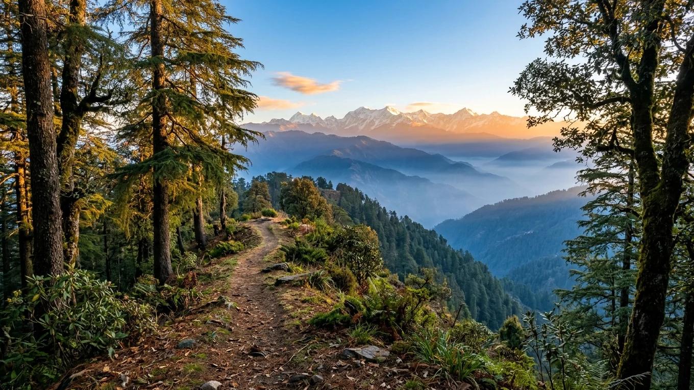
One of the primary appeals drawing discerning travellers to Kanatal is its commanding view of the Greater Himalayan range. On clear days, the high vantage points along the Kanatal ridge and nearby summits provide an unobstructed panorama spanning hundreds of kilometres of the Great Himalayan snowline in the Garhwal sector.
Prominent peaks visible across the northern horizon include:
- Bandarpunch (6,316 m) & White Peak (6,102 m): The legendary “Monkey’s Tail” massif in the Western Garhwal range, feeding the Yamuna and Tons river systems, stands prominently with its distinctive glaciated summit ridge.
- Swargarohini (6,252 m): A dramatically sculpted, sharp triple-peak ridge steeped in mythological lore as the “Stairway to Heaven” of the Mahabharata.
- Chaukhamba (7,138 m): The colossal four-pillared massif dominating the Badrinath and Mandakini valleys, visible as a massive square snow wall dominating the northeastern horizon.
- Trisul (7,120 m): On exceptionally clear days, the graceful three-pronged trident massif in the Nanda Devi sanctuary can be discerned far to the east.
However, an honest travel guide must present the reality of mountain visibility transparently. Himalayan panoramas are never an automated daily guarantee. During the summer pre-monsoon months (late April through June), rising thermal currents from the heated northern plains often carry dust and atmospheric moisture haze into the mid-altitude valleys by midday, obscuring distant peaks behind a milky white veil after 10:00 AM.
As explored in our detailed guide to autumn Himalayan panoramas, the optimal atmospheric window occurs from October through November. Following the withdrawal of the summer monsoon, rain washout (wet scavenging) cleans the entire troposphere of suspended particulate matter, relative humidity plunges to 35–55%, and the snowline stands razor-sharp against deep azure skies from dawn until sunset. In winter (December to February), crisp sunny mornings following cold fronts also deliver pristine visibility, provided you dress warmly for freezing early morning winds.
Kaudia Forest: Ancient Cedar Canopy & Gentle Walking Trails
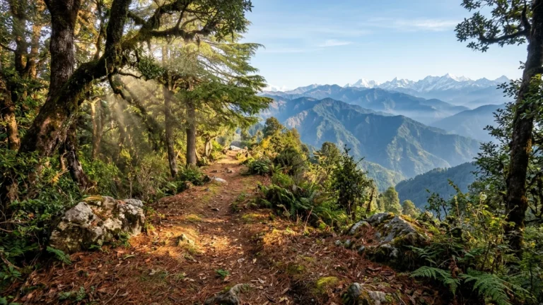
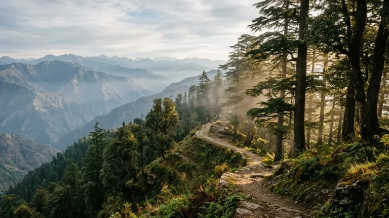
For nature enthusiasts, walking along the Kanatal ridge offers an experience rarely found in heavily tourist-oriented hill stations: peaceful, unhurried immersion in old-growth temperate forest. Located approximately 3 to 5 kilometres from Kanatal along the Mussoorie-Chamba highway, **Kaudia Forest** (also spelled Kodia Forest) is the crown jewel of the local ecosystem.
Administered as a protected reserve by the Uttarakhand Forest Department (Tehri Garhwal Division), Kaudia Forest preserves a rich, multi-tiered woodland canopy. Walking through the sanctuary, visitors are enveloped by towering Himalayan deodar cedars (*Cedrus deodara*), ancient ban oaks (*Quercus leucotrichophora*), kharsu oaks (*Quercus semecarpifolia*), and native rhododendrons (*Rhododendron arboreum*). The air is deeply fragrant with the scent of cedar resin and damp pine needles, and the forest floor is cushioned with fallen leaves and delicate ferns.
The Trail Experience
Unlike strenuous mountain treks that require intense physical conditioning, the main walking track through Kaudia Forest is uniquely accessible. Stretching for approximately 5 to 6 kilometres through the heart of the reserve, the path follows a broad, gently graded forest road with minimal elevation gain or loss. This makes Kaudia an exceptional walking destination for multi-generational families, leisure strollers, and travellers who want to experience the deep stillness of the Himalayas without strenuous climbing.
As you walk deeper into the forest, several natural freshwater springs (*dhara*) emerge from mossy rock faces, providing clean, ice-cold mountain water. Natural forest clearings intermittently break through the dense canopy, opening into breathtaking vistas of terraced valleys, distant Garhwal villages, and rolling hillsides. For those who prefer not to walk the full distance, authorized local 4×4 open safari jeeps can be engaged at the forest entrance barrier to traverse the main track.
Wildlife and Birdwatching
Kaudia Forest provides an important wildlife corridor in the Tehri hills. While larger mammals like leopards and Himalayan black bears remain secretive and rarely encountered, patient and quiet morning walkers frequently spot:
- Barking Deer (*Muntiacus muntjak* / Kakar): Often seen foraging among shaded undergrowth or heard sounding their distinctive alarm calls through the valley.
- Goral (*Naemorhedus goral*): Agile Himalayan cliff-dwelling goat-antelopes that navigate steep, rocky ravines along the outer edge of the forest.
- Mountain Birds: An abundant resident and migratory avian population, including the vivid Kalij Pheasant, Red-billed Blue Magpie, White-throated Laughingthrush, Blue-winged Minla, Grey-headed Woodpecker, and various flycatchers, warblers, and sunbirds.
Forest Etiquette: Entry to Kaudia Forest requires a nominal entry token paid at the Forest Department barrier checkpost. The reserve is strictly a day-use sanctuary; overnight camping is prohibited to protect wildlife corridors, and visitors must carry all plastic waste back to the village.
Surkanda Devi Temple: Sacred High Peak & The Passenger Ropeway
Perched commandingly on the conical summit of Surkanda mountain at an altitude of **2,750 to 2,757 metres (approx. 9,040 feet)**, Surkanda Devi Temple is the most prominent cultural and geographical landmark in the Kanatal-Dhanaulti corridor. Situated roughly 8 kilometres west of Kanatal near the roadside hamlet of Kaddukhal (Kadu Khal), the temple draws both spiritual pilgrims and mountain lovers seeking one of the finest 360-degree viewpoints in the Western Himalayas.
Mythological and Cultural Significance
Surkanda Devi is venerated as one of the 51 sacred *Shakti Peethas* in Hindu tradition. According to regional religious lore, when Goddess Sati immolated herself following the sacrifice performed by her father Daksha, Lord Shiva carried her body across the cosmos in grief and rage. As Lord Vishnu released his Sudarshana Chakra to disintegrate the body and restore universal balance, the head (*sur*) of the Goddess is believed to have fallen upon this high Garhwal summit, sanctifying the mountain as *Sur-khanda* (later corrupted to Surkanda).
The temple is deeply revered across Tehri Garhwal, and during the annual **Ganga Dashhara** festival (held between May and June), thousands of devotees ascend the mountain from surrounding villages, filling the peak with traditional Garhwali hymns, folk music, and colourful floral offerings.
Reaching the Peak: Trekking vs. The Modern Passenger Ropeway
Until recently, reaching the temple summit required a steep, strenuous pedestrian climb from the road head at Kaddukhal. While the paved trail covers a distance of approximately 1.5 to 2.5 kilometres (depending on the switchbacks taken), the path gains over 300 vertical metres at high altitude, demanding 45 to 75 minutes of steady physical effort that can challenge unconditioned walkers, senior citizens, and young children.
To make the shrine accessible to all pilgrims and visitors, Uttarakhand Tourism and a specialized ropeway consortium inaugurated a modern **monocable passenger cable car system**. The ropeway spans approximately 502 metres, transporting passengers from the Kaddukhal base terminal to the temple ridge in roughly 5 minutes. Gliding smoothly over oak-forested mountain slopes, the cable car offers breathtaking aerial views of the valleys below and eliminates the physical strain of the steep ascent.
The Summit Horizon
Standing on the windswept crest around the temple sanctum rewards visitors with an extraordinary 360-degree panoramic vista. Looking northward, the entire snow-clad Garhwal Himalayan range unfolds in full majesty, seemingly close enough to touch on crisp autumn mornings. Turning southward and westward reveals layered mountain ridges descending toward the foothills of Rishikesh, the distant Doon valley, and the high ridges of Chakrata and Pratapnagar. The peak is frequently kissed by passing clouds and mist, creating an ethereal, otherworldly atmosphere.
High-Altitude Ridge vs. Commercial Hill Station: A Comparative Analysis
Choosing Kanatal requires understanding how an unhurried, high-altitude ridge destination differs from conventional, commercially developed hill resorts. The following comparison highlights key differences across essential travel dimensions:
| Travel Dimension | Commercial Hill Stations (e.g., Mussoorie / Nainital) | Kanatal High-Altitude Ridge |
|---|---|---|
| Elevation | 1,900 – 2,084 metres (6,200 – 6,837 feet) | Approx. 2,590 metres (8,500 feet) |
| Summer Temperature | Warm days (24°C – 30°C); humid foothill air | Crisp alpine days (15°C – 24°C); cool breezy nights (12°C) |
| Traffic & Vehicle Access | Severe congestion; Mall Road vehicle bans; one-way choke points | Open mountain highway; free-flowing scenic ridge driving |
| Parking Reality | Acute shortages; municipal lots fill early; satellite holding diversions | Dedicated private on-site parking at roadside camps and inns |
| Atmosphere & Ambience | Commercial shopping promenades, video parlours, crowded street cafes | Quiet forest silence, deodar scent, starry nights, village footpaths |
| Snowfall Reliability | Infrequent; melts rapidly; intense traffic gridlock during snowfalls | Substantial winter snowfall (late Dec–mid Feb); true alpine frost |
| Walking Terrain | Steep, paved town staircases dodging scooters and tour groups | Gentle level forest trails (Kaudia) and high ridge footpaths |
| Ideal For | Boutique cafe hopping, colonial architecture tours, souvenir shopping | Nature lovers, stargazing, corporate offsites, peaceful family rest |
Road Corridors & Travel Logistics from Delhi NCR
Planning an effortless journey to Kanatal depends heavily on selecting the correct highway approach from the plains. While online navigation algorithms frequently recommend routing through Dehradun and Mussoorie simply based on straight-line highway distances, experienced Himalayan drivers know that this corridor is often plagued by severe holiday traffic jams.
The Recommended All-Weather Corridor (via Chamba)
The most reliable, relaxed driving corridor from Delhi NCR approaches Kanatal from the east via Rishikesh and Chamba:
- Delhi NCR to Rishikesh via NE-3 and NH-334: Depart Delhi or Noida via the Delhi-Meerut Expressway (NE-3), continuing past Muzaffarnagar and Roorkee along National Highway 334. Take the elevated Haridwar bypass straight to Rishikesh (approx. 240 km, 4.5 to 5.5 hours). This entire section is smooth, high-speed 4- to 6-lane highway with excellent food plazas like Cheetal Grand at Khatauli and Namaste Mid-Way near Mansurpur.
- Rishikesh to Chamba via NH-94 / NH-34: From Rishikesh, cross the Ganges and climb into the mountains on the newly engineered Chardham highway corridor ascending past Narendra Nagar to Chamba (approx. 55 km, 1.5 to 2 hours). This mountain highway is exceptionally well-built with wide two-lane asphalt, broad turning radii, concrete rockfall barriers, and gentle climbing gradients.
- Chamba to Kanatal: At the historic mountain junction of Chamba, turn onto the Mussoorie-Chamba scenic ridge road, ascending gently for another 15 to 16 kilometres (approx. 35 to 45 minutes) directly into Kanatal.
The total driving distance is approximately 310 kilometres (7.5 to 8.5 hours). By taking this route, you completely avoid the congested urban sprawl of Dehradun, the crowded switchbacks of Mussoorie, and the vehicular restrictions of hill town centres.
For drivers interested in exploring broader road trip planning across Uttarakhand and Himachal, our verified Delhi to Dhanaulti road trip guide and our round-up of weekend getaways from Delhi under 7 hours offer valuable comparative route insights.
The Alternative Western Corridor (via Dehradun & Mussoorie)
The alternative route enters the hills from Dehradun, climbing past Mussoorie and Dhanaulti to reach Kanatal from the west (approx. 320 km). While this route is picturesque, driving through Mussoorie during weekends, summer vacations, or long holidays can add between 1.5 and 3 hours of frustrating bumper-to-bumper delays along the Mall Road bypass. This route is best reserved for quiet mid-week travel or when Mussoorie itself is an intentional multi-day stop on your itinerary.
Mountain Driving Safety on the Chamba Ridge
While the road to Kanatal is fully paved and in excellent condition, driving at 8,500 feet requires disciplined mountain driving practices:
- Master Engine Braking: On long descents down from the Kanatal ridge toward Chamba or Kaddukhal, do not ride your foot brake continuously. Shift your transmission into a lower gear (second or third gear in manual vehicles; low or manual mode in automatics) to engage drivetrain resistance. Excessive continuous braking generates extreme heat, causing brake pad glazing and brake fluid vaporization that leads to sudden brake failure. For an authoritative technical breakdown, read our mountain driving safety protocols.
- Observe Uphill Right-of-Way: Under Regulation 21 of the Motor Vehicles (Driving) Regulations, 2017, when a hill road narrows and two vehicles cannot easily pass, the descending vehicle must pull over and give precedence to the ascending vehicle. Starting a loaded car from a dead stop on a steep mountain gradient is mechanically demanding and carries risk of rollback.
- Drive During Daylight: Plan your mountain departure so that you complete the hill climb in daylight. Mountain mist, unlit village cows, and unfamiliar sharp bends make night driving in the hills unnecessarily stressful.
Seasonal Rhythms: When to Visit Kanatal
At 8,500 feet, Kanatal experiences four dramatically distinct seasonal phases, each offering unique atmospheric qualities for travellers:
1. Spring (March to April): Wild Rhododendrons & Crisp Mornings
As winter’s frost recedes, spring arrives with clear, bright sunlight and cool, refreshing mountain breezes. The native *Buransh* (rhododendron) trees throughout Kaudia Forest and the Surkanda slopes burst into deep crimson and scarlet blooms, contrasting vividly with the dark green cedar canopy. Daytime temperatures range from 14°C to 20°C, while nights remain crisp (6°C to 11°C). This is an ideal season for forest walking, bird photography, and peaceful couple retreats.
2. Summer (May to June): The High Alpine Refuge
When the northern plains swelter under blistering 40°C–45°C heatwaves, Kanatal functions as a high-altitude natural air conditioner. Shaded by dense oak and cedar woodlands and sitting at 8,500 feet, daytime temperatures remain comfortably between 18°C and 25°C, accompanied by continuous cool ridge breezes. Evenings are pleasantly cold (12°C to 15°C), requiring light woollens or fleeces. It is a prime window for corporate team-building retreats and outdoor family camping.
3. Autumn (October to November): Crystalline Skies & Golden Light
Following the withdrawal of the monsoon, October and November provide the most spectacular mountain visibility of the year. The atmosphere is thoroughly cleansed of suspended dust, relative humidity drops sharply, and the Great Himalayan snow peaks stand out in razor-sharp relief against deep blue skies. Days are mild and sunny (12°C to 18°C), while nights turn sharply cold (2°C to 8°C), making outdoor evening campfires and stargazing deeply restorative.
4. Winter (December to February): Snowfall, Frost & Fireside Solitude
Winter transforms Kanatal into a true alpine wonderland. Sub-zero overnight temperatures (-3°C to 3°C) paint pine needles and grasses with thick morning frost, and periodic Western Disturbances bring substantial snowfall events between late December and mid-February. When it snows, the entire ridge is blanketed in pristine white, creating a magical winter escape within driving distance of Delhi NCR. Heavy thermal down jackets, insulated gloves, and waterproof footwear are essential.
Nearby Excursions: Tehri Lake & Dam Water Sports
While Kanatal’s primary appeal lies in quiet forest walks and relaxation, travellers staying for three or four days can easily incorporate an exciting half-day excursion to **Tehri Dam and Lake**, located approximately 35 kilometres northeast via Chamba (about 1 to 1.25 hours drive).
Constructed across the Bhagirathi and Bhilangna rivers, Tehri Dam is one of the tallest dams in Asia, creating an enormous 42-square-kilometre freshwater reservoir cradled within towering green mountains. At the authorized tourism hub of Koti Colony along the lake shore, the Tehri Special Tourism Area Authority oversees a comprehensive water sports complex.
Visitors can experience:
- High-Speed Boating & Jet Skiing: Skimming across the emerald waters of the reservoir under the guidance of certified aquatic instructors.
- Banana Boat Rides & Bumper Tubes: Exciting group water rides ideal for corporate offsite teams and families with older children.
- Scenic Pontoon Cruises: Leisurely motorboat tours navigating deep mountain gorges and submerged valleys that offer dramatic landscape photography.
After an active morning on the water, the scenic drive back up the mountain highway brings you back to the peaceful, cool 8,500-foot ridge of Kanatal in time for evening tea overlooking the sunset valleys.
Lodging Strategy: Adventure Camps vs. Boutique Mountain Inns
Where you choose to base yourself in Kanatal depends largely on your travel style and preferences. Accommodation along the ridge falls broadly into two curated categories: outdoor alpine adventure camps and solid brick-and-mortar mountain inns.
For travellers who want to immerse themselves in nature, wake up to birdsong in orchard groves, and participate in outdoor activities, alpine camp retreats offer a memorable experience. Situated on the Chamba-Mussoorie highway near Kanatal, Kanatal Camps & Cottages features insulated wooden timber chalets with private viewing balconies as well as deluxe Swiss-style canvas tents pitched on elevated stone foundations with attached modern western bathrooms. The property provides dedicated on-site parking, mountain lawns for evening bonfires, and on-site adventure activities such as zip-lining, Burma bridge crossings, and obstacle rope courses supervised by trained instructors.
For multi-generational families with elderly members, couples seeking a quiet romantic sanctuary, or travellers who prefer traditional indoor hotel comforts, roadside boutique mountain inns like Cozypine Kanatal provide solid masonry guest rooms with panoramic valley-facing glass windows, private balconies, an indoor heated dining hall, and an open rooftop terrace overlooking the pine-clad hillsides.
In accordance with Upvan’s transparent partner disclosure policy, Upvan Hotels & Resorts coordinates, verifies, and curates direct bookings at both partner properties with local hosts, ensuring personalized service, transparent pricing, and rigorous quality without claiming direct property ownership.
For families planning mountain journeys, our specialized guide to planning family holidays in the hills with open meadows offers valuable insights into selecting safe outdoor stays for children and grandparents. To explore additional handpicked retreats across Uttarakhand and Himachal Pradesh, browse our complete collection of curated mountain destinations.
Frequently Asked Questions (FAQ)
What is the exact elevation of Kanatal, and how does it compare to Mussoorie?
Kanatal sits on an elevated mountain ridge at an altitude of approximately 2,590 metres (roughly 8,500 feet) above sea level. In comparison, Mussoorie’s Mall Road sits significantly lower at approximately 2,000 metres (6,560 feet), while the valley town of Chamba rests at around 1,600 metres. Because Kanatal is nearly 600 vertical metres higher than Mussoorie, it experiences noticeably cooler alpine temperatures, lower humidity, fresher mountain breezes, and more frequent winter snowfall.
How do you reach Surkanda Devi Temple from Kanatal, and is the cable car operational?
Surkanda Devi Temple is located approximately 8 kilometres west of Kanatal along the road toward Mussoorie. The departure point for the temple is the roadside settlement of Kaddukhal (Kadu Khal). From Kaddukhal, visitors can either embark on a steep 1.5 to 2.5 kilometre paved uphill walk that gains over 300 vertical metres in elevation, or ride the modern passenger ropeway (cable car). The ropeway covers roughly 502 metres, transporting passengers to the temple ridge in approximately 5 minutes, making the shrine accessible for elderly travellers and families.
What can visitors do in Kaudia Forest, and is an entry permit required?
Kaudia Forest (located 3 to 5 km from Kanatal) is a dense protected forest sanctuary featuring ancient deodar cedars, ban oaks, and wild rhododendrons. The primary activity is an unhurried 5 to 6 kilometre level walk along a wide, gentle dirt track with minimal gradient, making it accessible to all ages. Visitors can enjoy peaceful nature walks, birdwatching (pheasants, woodpeckers, thrushes), freshwater springs, and sweeping valley vistas. Authorized local open 4×4 safari jeeps can also be hired at the entrance. Entry requires a nominal permit token at the Forest Department barrier, and the forest is strictly a plastic-free, day-access zone.
Which driving route from Delhi NCR to Kanatal avoids Mussoorie traffic?
To avoid the notorious weekend traffic bottlenecks of Dehradun and Mussoorie, drivers from Delhi NCR should take the eastern all-weather highway corridor via Rishikesh and Chamba. Drive along the Delhi-Meerut Expressway (NE-3) and NH-334 to Rishikesh (approx. 240 km), then climb into the hills on the wide, newly engineered all-weather mountain highway (NH-94/NH-34) through Narendra Nagar to Chamba (approx. 55 km). From Chamba, a smooth 15-kilometre ridge road leads directly into Kanatal. Total distance is approximately 310 km (7.5 to 8.5 hours).
Does it snow in Kanatal, and what is the best month to experience snowfall?
Yes. Due to its high elevation of 8,500 feet, Kanatal receives substantial snowfall during the winter season. The most reliable window for experiencing snowfall is between late December and mid-February, when periodic Western Disturbances bring cold fronts across the Garhwal Himalayas. Overnight temperatures regularly drop below freezing (-3°C to 3°C), and snow can blanket the forest and mountain ridge. Visitors traveling in winter must pack heavy thermal down jackets, woollen caps, insulated gloves, and sturdy footwear.
What types of accommodation are available in Kanatal through Upvan?
Upvan coordinates bookings at two curated partner properties in Kanatal catering to different travel preferences: Kanatal Camps & Cottages offers outdoor alpine glamping in insulated timber chalets and deluxe Swiss-style tents with on-site adventure activities, mountain lawns, and evening bonfires; while Cozypine Kanatal provides traditional boutique hotel lodging with solid masonry rooms, valley-view private balconies, an indoor heated dining hall, and rooftop terrace views. Both properties feature dedicated on-site parking.
Plan an Unhurried High-Altitude Escape to Kanatal
Bypass crowded hill-station traffic and breathe the pure alpine air of the Garhwal Himalayas. Whether you are seeking insulated wooden chalets with panoramic snow-peak views, peaceful deodar forest walks in Kaudia, or customized corporate and family itineraries, our travel specialists are ready to curate your mountain retreat.
Plan Your Mountain Retreat with Upvan
Experience handpicked mountain resorts, pine-sheltered cottages, and riverside sanctuaries across Himachal Pradesh, Uttarakhand, and near Delhi NCR. Enjoy verified hospitality, best direct rates, and personalized mountain itineraries.