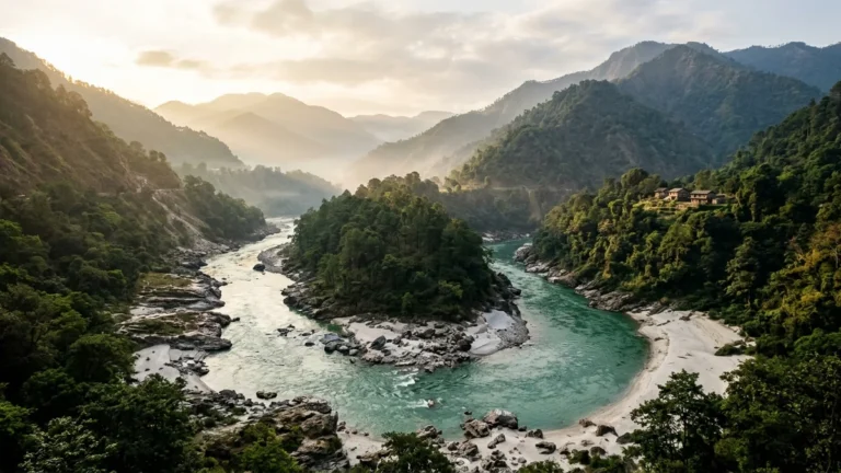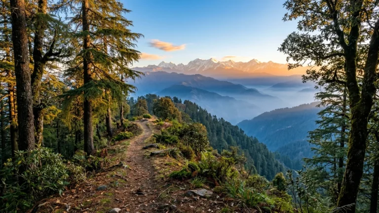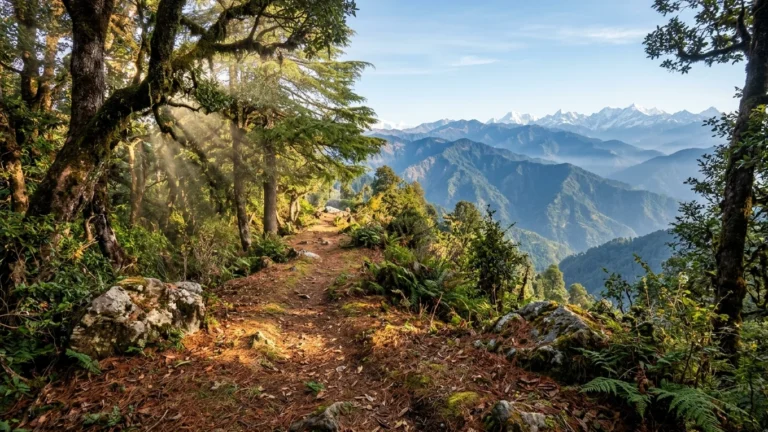
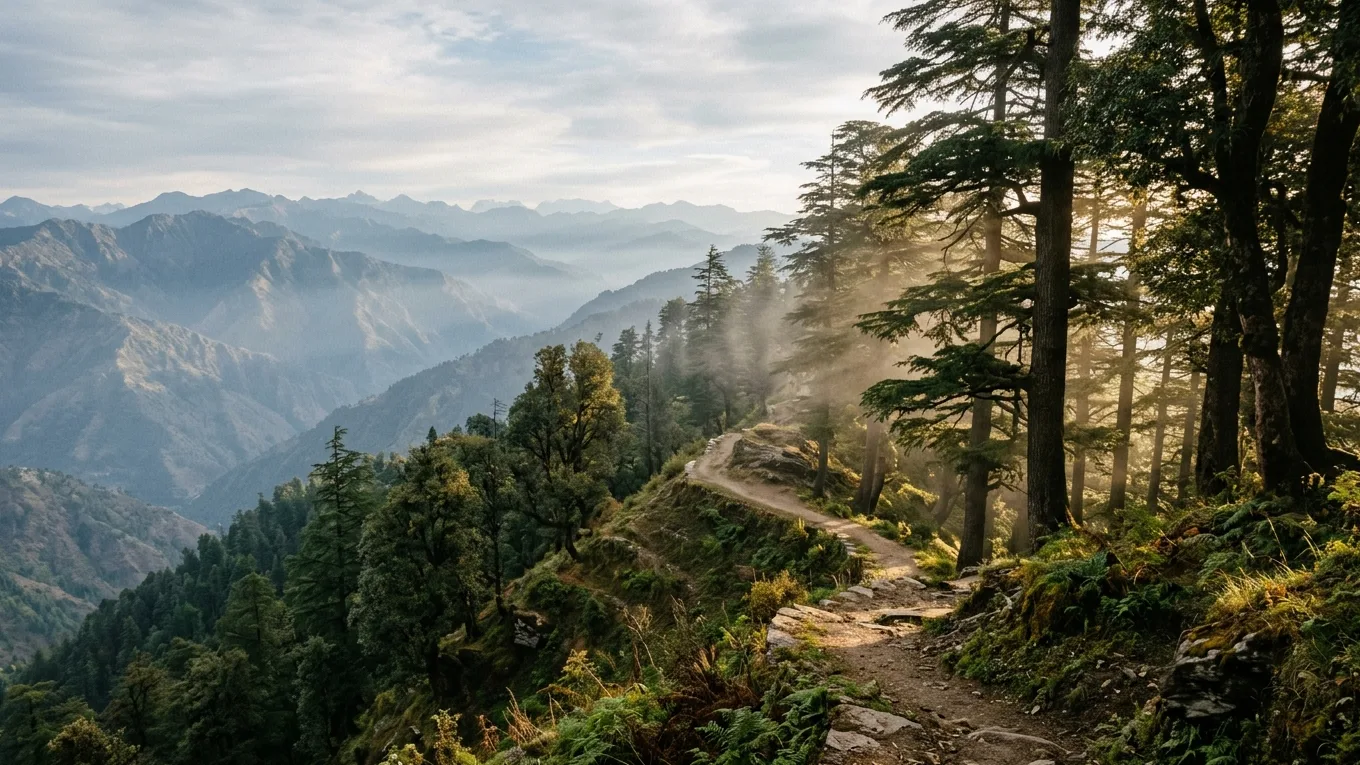
Chakrata at a Glance: Tucked away in the Jaunsar-Bawar highland region of Dehradun district at an elevation of approximately 2,100 meters (6,900 feet), Chakrata is one of Uttarakhand’s most secluded mountain retreats. Established in the late 1860s as a British military cantonment and remaining an active defense station today, the town is defined by ancient groves of Himalayan cedar (Cedrus deodara), quiet forest trails, and deep mountain stillness. Located roughly 315 kilometers north of Delhi NCR, Chakrata offers travellers dramatic natural landmarks, including the 312-foot plunge of Tiger Falls, sweeping sunset vistas from Chilmiri Neck, limestone formations at Budher Caves, and ancient cedar canopies at Deoban. Because Chakrata is an active cantonment, specific travel regulations apply: Indian citizens must carry original government-issued photo identification, while foreign nationals face strict entry restrictions under defense regulations.
| Travel Parameter | Verified Detail |
|---|---|
| Geographic Altitude | Approx. 2,100 meters (6,900 feet) at town ridge; wilderness ridges exceed 2,800 meters |
| Administrative Location | Dehradun District, Jaunsar-Bawar Region, Uttarakhand, India |
| Distance from Delhi NCR | Approx. 315 km from Central/North Delhi / ~345 km from Gurgaon / ~325 km from Noida |
| Driving Duration | Approx. 7 to 8 hours via NH44, Paonta Sahib, Vikasnagar, and Kalsi |
| Best Travel Seasons | April to June (Pleasant alpine summer) & September to November (Crisp skies and clear panoramas) |
| Primary Appeal | Ancient deodar canopies, waterfall hikes, starlit night skies, uncommercialized quiet |
| Regulatory Requirement | Indian citizens must carry original government photo ID; foreign nationals restricted |
| Curated Stay Option | Chakrata Camps & Cottages (Verified Upvan Partner Stay) |
Why Chakrata Feels Different: The Deodar Highlands of Western Garhwal
Most road journeys from Delhi into Uttarakhand follow familiar corridors: through Haridwar toward Rishikesh, or up the busy switchbacks from Dehradun into Mussoorie. Yet at the historic foothill gateway of Kalsi, where the Yamuna River emerges from the hills, a quieter two-lane highway branches northward along the Tons river valley before climbing into the Jaunsar-Bawar highlands.
Ascending beyond the 1,500-meter contour along NH707A, the air cools noticeably. Subtropical river valleys give way to slopes forested with Himalayan Cedar (Cedrus deodara), silver firs, and banj oaks. The roadside stalls, souvenir shops, and heavy tourist traffic typical of popular hill stations are absent, replaced by terraced village homesteads, crisp pine breezes, and steep limestone gorges.
Chakrata occupies a distinct niche among North Indian hill stations. Unlike resort towns built around commercial malls and promenades, Chakrata remains an unhurried settlement where days are shaped by forest paths, birdcalls, and passing mist. There are no commercial shopping complexes or noisy traffic circuits.
For travellers departing Delhi NCR, this quiet character provides genuine respite. Chakrata is built for nature-focused exploration: a morning walk through cedar woods, an afternoon exploring limestone caverns, or an evening watching alpenglow settle across the snow peaks of the Greater Himalayas. To evaluate how this ridge fits into broader getaway plans, explore our curated Chakrata destination guide and stays.
Getting There: Driving from Delhi NCR to the Garhwal Foothills
The drive from Delhi NCR to Chakrata covers approximately 315 kilometers and takes roughly 7 to 8 hours under normal highway conditions. The route transitions from fast multi-lane plain expressways to scenic foothill bypasses and a steady mountain ascent.
Route at a Glance: Delhi NCR (NH44) → Panipat / Karnal → Yamunanagar → Paonta Sahib → Vikasnagar → Kalsi (NH707A) → Chakrata (Approx. 315 km, 7–8 hours)
The Recommended Highway Corridor
The most practical driving route follows the northern highway corridor through Haryana and Himachal Pradesh into southwestern Uttarakhand:
- Delhi NCR to Yamunanagar via NH44: Depart early along NH44 past Panipat and Karnal, turning eastward toward Yamunanagar. Starting before 6:00 AM avoids commuter congestion.
- Yamunanagar to Paonta Sahib & Vikasnagar: Continue northeast across the border to Paonta Sahib on the Yamuna River, crossing into Uttarakhand toward Vikasnagar.
- Vikasnagar to Kalsi: Drive roughly 15 kilometers along the river basin to Kalsi, marking the Shivalik foothill threshold.
- Kalsi to Chakrata via NH707A: Climb the 45-kilometer mountain road along NH707A up to the 2,100-meter ridge. The two-lane paved hill road features gradual inclines and occasional narrow passages near cantonment borders.
Road Realities & Fuel Advice
While the plains stretch is rapid, the final 45 kilometers from Kalsi require patient daylight mountain driving:
Fuel & ATMs: Vikasnagar and Kalsi are the last commercial towns with multiple reliable fuel pumps and ATMs. Chakrata town has a single local pump with fluctuating supply, so refuel completely before climbing.
Daylight Driving: Complete the mountain stretch in full daylight, as unpaved curves and roadside gravel are difficult to navigate after dark. For general principles on mountain car control, our Delhi to Chail driving route guide covers useful hill driving fundamentals.
Chakrata Cantonment: Important Access Rules & Travel Protocols
To travel thoughtfully in Chakrata, understanding its administrative character is essential. Chakrata is an active military cantonment established in the late 1860s in the Jaunsar-Bawar highland region. Administered by the Chakrata Cantonment Board under the Ministry of Defence, the town maintains designated defense zones alongside civilian areas. This defense presence has kept the hill station quiet, heavily forested, and sheltered from uncontrolled construction.
Because of its strategic status, specific travel guidelines are strictly maintained:
1. Regulations Concerning Foreign Nationals
Due to strategic defense classifications, Chakrata Cantonment and its surrounding zones (including Tiger Falls) are subject to strict entry restrictions for foreign nationals. Non-Indian passport holders, overseas tourists, and international visitors require prior authorized clearance from military and civil authorities to enter the cantonment jurisdiction. Such permissions are rarely granted for casual leisure tourism. International travellers are strongly advised to choose alternative, unrestricted Garhwal destinations—such as Kanatal, Dhanaulti, or Mussoorie—to avoid administrative complications or being turned back at checkposts.
2. Identification Requirements for Indian Citizens
Indian citizens do not require advance permits to visit Chakrata or stay at local guest facilities. However, all adult travellers must carry original government-issued photo identification (such as an Aadhaar Card, Voter ID, Indian Passport, or Driving License). Security personnel conduct identification checks at military barricades along approach roads from Kalsi and Mussoorie. Digital copies on phones may not always be accepted, so keeping physical ID cards accessible in your vehicle is essential.
3. Drone Operations & Photography Boundaries
Civilian Drone Prohibition: Operating civilian drones or uncrewed aerial vehicles (UAVs) anywhere within the Chakrata cantonment perimeter or over surrounding valleys is strictly prohibited under national airspace regulations governing military zones. Flying a drone here can result in equipment confiscation and formal legal intervention.
Photography Guidance: Photography of military installations, army entry barricades, communication towers, security checkposts, or defense administrative compounds is strictly forbidden. Visitors should keep cameras focused on natural landscapes, cedar forests, public walking trails, and open valley vistas.
These procedures are routine for eligible travellers who arrive prepared. Carrying proper identification and respecting local defense signage ensures a smooth visit to this corner of Uttarakhand.
Tiger Falls: Hiking Down to Uttarakhand’s Thunderous Cascade
Among the natural landmarks surrounding Chakrata, Tiger Falls (known locally as Kerao Pachad) is the most celebrated. Dropping from a sheer limestone cliff at an approximate height of 312 feet (around 95 meters), it is one of the highest direct plunge waterfalls in Uttarakhand.
Trail Flow: Roadhead Parking Area → Steep Stone Stairway (~1.5 km descent) → Tiger Falls Pool Basin → Return Ascent (Demanding uphill climb, 1+ hour)
Fed by clean mountain streams flowing through the upper ridge forests, the waterfall drops in an unbroken curtain into a natural stone basin, throwing a cool spray across the oak gorge. The sound of cascading water carries through the trees well before the falls come into view.
Trail Logistics & The Return Climb
Two primary routes lead to Tiger Falls:
The Roadhead Trail (Standard Approach): Travellers drive roughly 18 to 20 kilometers from Chakrata town along a winding hill road to the designated roadhead parking area. From here, a marked stone stairway descends approximately 1.5 kilometers into the gorge basin.
The Traditional Town Trail (Long Route): For experienced hikers, a traditional walking path leads roughly 5 kilometers down through oak and rhododendron forests directly from the Chakrata town ridge.
Physicality & Safety Assessment
While descending the 1.5-kilometer stone staircase is straightforward and takes about 30 to 45 minutes, the return climb is physically demanding:
The Uphill Ascent: Climbing back up requires negotiating a continuous, steep elevation gain. For travellers of average fitness, the ascent takes an hour or more at a measured pace. The stone steps are often damp from mountain mist, requiring cautious footing.
Footwear & Provisions: Wear sturdy walking shoes or hiking boots with deep rubber tread. Smooth-soled sneakers and sandals are ill-suited for wet stone steps.
Self-Assessment: Families traveling with young children or elders should assess fitness honestly before descending all the way to the pool basin. Turning around at one of the upper valley viewpoints is wiser than struggling on the return climb.
Provisions & Daylight: Facilities at the base are minimal, consisting of small local tea stalls that operate seasonally. Carry drinking water and light snacks, and begin your return climb well before late afternoon to reach your vehicle in full daylight.
Chilmiri Neck: Sunset Panoramas and Garhwal Ridge Vistas
Located just 4 kilometers from Chakrata town center, Chilmiri Neck is an accessible high vantage point sitting at approximately 2,160 meters. It forms an expansive, flat plateau along a high mountain spur bordered by deodar groves.
In the late afternoon, Chilmiri Neck becomes the natural gathering spot for visitors looking across the Garhwal valleys. Because the plateau projects outward with few visual obstructions, it offers sweeping panoramic views across the Greater Himalayan horizon. On clear autumn and winter evenings, the snowy profiles of prominent peaks—including the Bandarpoonch and Swargarohini massifs—glow with golden alpenglow as the sun dips below the western ridges.
Beyond sunsets, Chilmiri Neck is a peaceful setting for daytime nature walks and birdwatching. The surrounding woods shelter blue whistling thrushes and verditer flycatchers. The plateau’s flat terrain provides easy walking underfoot, making it suitable for families.
Travel Note: Because the plateau is exposed to mountain winds, temperatures drop rapidly once the sun sets. Carrying a windproof jacket or fleece sweater is recommended even on sunny spring and summer evenings.
Budher Caves & Moila Top: Ancient Limestone Formations and Alpine Meadows
For travellers eager to experience Chakrata’s deeper wilderness, an excursion to Budher Caves and Moila Top provides a rewarding day of mountain walking and geological exploration. Situated roughly 30 kilometers north of Chakrata at an elevation approaching 2,738 meters, the area feels completely removed from human settlements.
The Historic 1868 Forest Rest House
The trailhead begins near the historic Budher Forest Rest House, built by British foresters in 1868. Constructed from local deodar timber and fieldstone, the rest house stands in a tranquil forest clearing framed by ancient cedar trees, representing classic nineteenth-century Himalayan forestry architecture.
The Moila Bugyal Hike
From the forest clearing, an easy-to-moderate trail winds upward for roughly 2.5 to 3 kilometers through pine and spruce woods before opening onto Moila Bugyal—a rolling alpine meadow carpeted with wild grasses. Walking across this high ridge offers expansive open skies and panoramic mountain views.
The Limestone Caves (Miola Caves)
Tucked within the rocky limestone outcrops of the meadow are the entrances to the Budher Caves, known locally as the Miola Caves after the German explorer who documented them. Regional folklore associates these underground caverns with the Mahabharata, believing they were utilized by the Pandavas during their mountain exile. The caves feature natural limestone karst formations with narrow passages opening into chambers where stalactites and stalagmites have formed over millennia.
Caving Caution: Exploring inside limestone fissures requires sturdy footwear, reliable headlamps, and caution, as cave floors are cold, uneven, and slippery. Casual visitors should admire cave entrances safely from outside without crawling into unmarked shafts without an experienced local guide.
Deoban: Walking Through Ancient Deodar Canopies at 2,800+ Meters
Rising to an altitude exceeding 2,800 meters (around 9,300 feet), Deoban—literally the Forest of the Gods—is the highest wilderness ridge in the immediate Chakrata circuit, located roughly 13 kilometers north of town.
Here, the deodar forest reaches an extraordinary level of maturity. Trees that have stood for centuries rise with massive trunks, their dense needle canopies interlocking high above to filter midday sunlight into a soft green twilight. The forest floor is cushioned with cedar needles, and the air carries a deep resinous scent rare in commercialized hill districts.
High-Altitude Himalayan Panoramas
At the highest clearing of Deoban, the forest opens to reveal an expansive vista. On crisp, cloudless mornings—particularly during October, November, and early spring—the view spans the northern horizon, showcasing an uninterrupted chain of snow-clad Himalayan massifs against deep blue skies.
An Avian Haven
Deoban is renowned among naturalists as one of the finest bird habitats in western Uttarakhand. The undisturbed canopy supports Himalayan woodpeckers, white-collared blackbirds, rufous sibias, and yellow-billed choughs riding the ridge thermals.
The drive from Chakrata to Deoban follows an unpaved forest track that can be rough and narrow. While high-clearance vehicles handle the route comfortably in dry weather, visiting after heavy rain or winter snow requires checking local road conditions beforehand.
Kalsi: The 3rd-Century BCE Ashokan Rock Edict at the Foothill Gateway
A visit to Chakrata is enriched by pausing at Kalsi, situated at the foothill threshold roughly 45 kilometers before the mountain ascent. Located near the confluence where the Tons River joins the Yamuna, Kalsi holds deep historical significance.
The Rock Edict of Emperor Ashoka (253 BCE)
Preserved within an open pavilion maintained by the Archaeological Survey of India (ASI) stands a monumental quartz boulder bearing the Fourteen Rock Edicts of Mauryan Emperor Ashoka, dating back to approximately 253 BCE.
Engraved in the ancient Brahmi script and Prakrit language, these inscriptions are among the northernmost major rock edicts discovered in India. The edicts proclaim the emperor’s moral principles following his conversion to Buddhism, advocating compassion and non-violence (ahimsa), medical facilities for humans and animals, respect for elders, tolerance between faiths, and public welfare along highways.
A finely etched profile of an elephant, titled Gajatama (the supreme elephant), adorns the rock face above the inscriptions, symbolizing the Buddha.
Taking an hour to walk through the peaceful ASI gardens at Kalsi on your drive toward Chakrata offers a contemplative reminder of the ancient trade routes and philosophical traditions that have crossed these river valleys for over two millennia.
Best Time to Visit: Weather, Seasons and Mountain Dynamics
Because Chakrata sits above 2,100 meters, its seasonal character varies throughout the year:
| Season | Atmospheric Character | Travel Dynamic |
|---|---|---|
| Spring & Summer (Apr–Jun) | Sunny days (16°C–27°C), cool nights | Ideal for day hikes, outdoor camping & meadow walks |
| Autumn (Sep–Nov) | Crystalline skies, sharp evening chill | Prime for Himalayan peak panoramas & dark-sky stargazing |
| Winter (Dec–Feb) | Freezing nights (sub-zero), morning frost | Quiet winter seclusion; periodic snowfall; black-ice caution |
| Monsoon (Jul–Aug) | Roaring waterfalls, vibrant green valleys | Maximum cascade volume; localized road slips require caution |
1. Spring & Summer (April to June): Pleasant Alpine Respite
As plains temperatures climb, Chakrata offers refreshing alpine weather. Daytime temperatures typically range between 16°C and 27°C, accompanied by light mountain breezes and bright skies. Evenings are pleasantly cool (10°C to 15°C). This is the premier season for hikes to Tiger Falls, outdoor camping, and exploring Moila Top.
2. Autumn (September to November): The Clearest Himalayan Panoramas
Autumn is considered the finest season to explore Chakrata. Following the retreat of monsoon rains, the air is clean of dust and haze. Daytime temperatures hover around 15°C to 20°C, while nights turn sharp (5°C to 10°C). Autumn delivers the most reliable panoramic views of the Greater Himalayan peaks and crystalline night skies ideal for stargazing.
3. Winter (December to February): Crisp Cold & Seasonal Snow
Winter transforms the cedar forests into a cold-weather mountain retreat. Temperatures drop below freezing at night (sub-zero to 10°C daytime), and heavy frost coats the forest needles each morning.
Snowfall Dynamics: Chakrata typically receives moderate to heavy snowfall between late December and early February, blanketing the cedar groves and high ridges of Chilmiri Neck and Deoban.
Winter Driving Caution: Shaded northern hairpins along the Kalsi–Chakrata road can develop thin patches of invisible morning ice (black ice). Winter visitors must drive cautiously, maintain moderate speeds, and avoid sudden braking. Thermal base layers, heavy woollens, and windproof outer jackets are essential.
4. Monsoon (July to August): Lush Greenery & Waterfall Power
During the monsoon, the valleys turn vibrant emerald green and Tiger Falls swells to its most thunderous volume. However, the mountain road between Kalsi and Chakrata is prone to localized rockfalls during prolonged heavy downpours. Travellers visiting during the rains should monitor local PWD road advisories and maintain flexible schedules.
Suggested 3-Day / 2-Night Itinerary: An Unhurried Mountain Circuit
To experience Chakrata’s forests, heritage, and walking trails without rushed road fatigue, a 3-day, 2-night circuit provides a sensible outline. The following schedule is suggested as an unhurried travel outline that can be adjusted to your group’s pace.
Day 1: The Foothill Gateway & Sunset Ridge
Morning (6:00 AM – 1:30 PM): Depart Delhi NCR via NH44 through Karnal and Yamunanagar to Paonta Sahib. Enjoy lunch near Vikasnagar.
Afternoon (2:00 PM – 4:00 PM): Pause at Kalsi to explore the 3rd-century BCE Ashokan Rock Edict. Ascend the 45-kilometer mountain road along NH707A, checking into your stay in Chakrata by late afternoon.
Evening (5:00 PM – 7:00 PM): Drive to Chilmiri Neck to watch the sunset illuminate the Garhwal peaks. Return to camp for an evening campfire and hot dinner under starlit skies.
Day 2: Waterfall Trails & Alpine Caverns
Morning (8:30 AM – 1:00 PM): Drive to the roadhead for Tiger Falls. Descend the 1.5-kilometer stone staircase through the oak gorge, spend time at the cascade, and make the steady climb back up before midday heat.
Afternoon (2:00 PM – 5:30 PM): Drive north toward Budher. Embark on the meadow walk across Moila Bugyal, view the historic 1868 Forest Rest House, and observe the limestone formations of Budher Caves.
Evening (7:00 PM onwards): Relax at your stay with an unhurried dinner, stargazing, and restful mountain quiet.
Day 3: Ancient Cedar Canopies & Return Journey
Morning (7:30 AM – 10:30 AM): Drive to Deoban to walk through ancient deodar groves and take in morning panoramas of the Greater Himalayas.
Midday (11:30 AM onwards): Check out from your accommodation and begin the steady daylight descent to Kalsi and Vikasnagar. Rejoin the plains highway via Paonta Sahib and NH44, returning to Delhi NCR by mid-evening.
Where to Stay: Forest Cottages & Wilderness Camping in Chakrata
Because Chakrata has resisted mass commercialization, accommodation options are centered on low-impact nature lodges, stone cottages, and wilderness campsites situated along forested hillsides outside town congestion.
Curated Partner Retreat — Chakrata Camps & Cottages
- Setting: Secluded forest clearing surrounded by ancient deodar canopies outside town bustle
- Lodging: Rustic timber-and-stone cottages and sturdy alpine Swiss tents on raised platforms
- Comfort: Private attached washrooms equipped with hot water heating facilities
- Dining: Homestyle Garhwali and North Indian meals served in an enclosed dining hall
- Evenings: Communal campfire gatherings under starlit Himalayan skies
For travellers seeking an authentic, uncrowded mountain base, Chakrata Camps & Cottages provides a peaceful setting nestled amidst cedar groves. The property offers a balanced combination of solid rustic timber-and-stone cottages and sturdy, weatherproof alpine Swiss tents erected on raised platforms. Each unit features comfortable bedding and private attached washrooms equipped with hot water heating facilities.
Wholesome, freshly prepared North Indian and regional Garhwali meals are served in a communal mountain dining hall, with evening campfires arranged on open grassy lawns under the stars.
Travel Preparation Note: Because Chakrata experiences sharp evening chills throughout the year and sub-zero temperatures during winter, pack adequate thermal woollens and layered clothing. To review seasonal cottage availability, discuss winter heating arrangements, coordinate group requirements, or receive real-time road advisories, speak directly with the Upvan Reservation Desk.
Practical Mountain Driving & Packing Guidelines
Preparation ensures a smooth journey into the Jaunsar-Bawar highlands:
Packing Essentials
Clothing: Layering is essential at high Garhwal elevations. Pack lightweight thermal base layers, a fleece mid-layer, and a windproof, water-resistant outer jacket even in summer. In autumn and winter, woollen caps, thermal gloves, and insulated jackets are mandatory.
Footwear: Sturdy walking shoes or trail boots with deep rubber lugs are essential for the stone steps of Tiger Falls and the unpaved paths of Deoban and Moila Bugyal. Smooth-soled footwear is unsafe on damp stone.
Health & First Aid: Pack motion-sickness medication for the winding 45-kilometer mountain road above Kalsi, along with personal prescriptions and basic first-aid supplies. Pharmacies in Chakrata town carry basic items, but specialized medicines are scarce.
Cash & Connectivity: While Jio and Airtel provide functional cellular data in Chakrata town and around main campsites, coverage diminishes on remote forest trails toward Budher and Deoban. ATMs on the ridge can intermittently experience network outages, so carry sufficient cash from Vikasnagar or Kalsi.
Mountain Road Etiquette
Always yield right-of-way to ascending vehicles on narrow hill sections.
Avoid overtaking on blind corners or sharp hairpins.
Use lower engine gears rather than riding vehicle brakes continuously during the downhill descent from Chakrata to Kalsi, preventing brake fade.
Keep headlights on low beam when driving through evening mountain fog. For travellers who appreciate quiet walking trails and want to explore similar cedar-lined destinations across the Himachal border, our guide to the pine forest trails of Chail offers another perspective on secluded Himalayan travel.
Planning Your Chakrata Journey with Upvan
Whether you are organizing a weekend road trip from Gurgaon, a small family nature retreat, or a photography journey across the Western Garhwal highlands, Chakrata rewards travellers who appreciate stillness, ancient trees, and unspoilt mountain trails.
Upvan Hotels & Resorts provides direct, human-led booking assistance for discerning travellers. We help you select the most suitable cottage or alpine tent setup, coordinate wholesome meal arrangements, and provide verified route advisories tailored to current hill conditions—without hidden fees or third-party broker markups.
- To begin planning your mountain journey, explore our full directory of curated mountain destinations.
- For personalised room allotment, group offsite coordination, or seasonal road guidance, connect directly with the Upvan Reservation Desk or message our travel desk on WhatsApp at +91 9718200365.
Plan Your Mountain Retreat with Upvan
Experience handpicked mountain resorts, pine-sheltered cottages, and riverside sanctuaries across Himachal Pradesh, Uttarakhand, and near Delhi NCR. Enjoy verified hospitality, best direct rates, and personalized mountain itineraries.