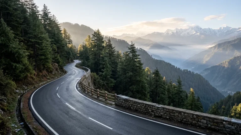
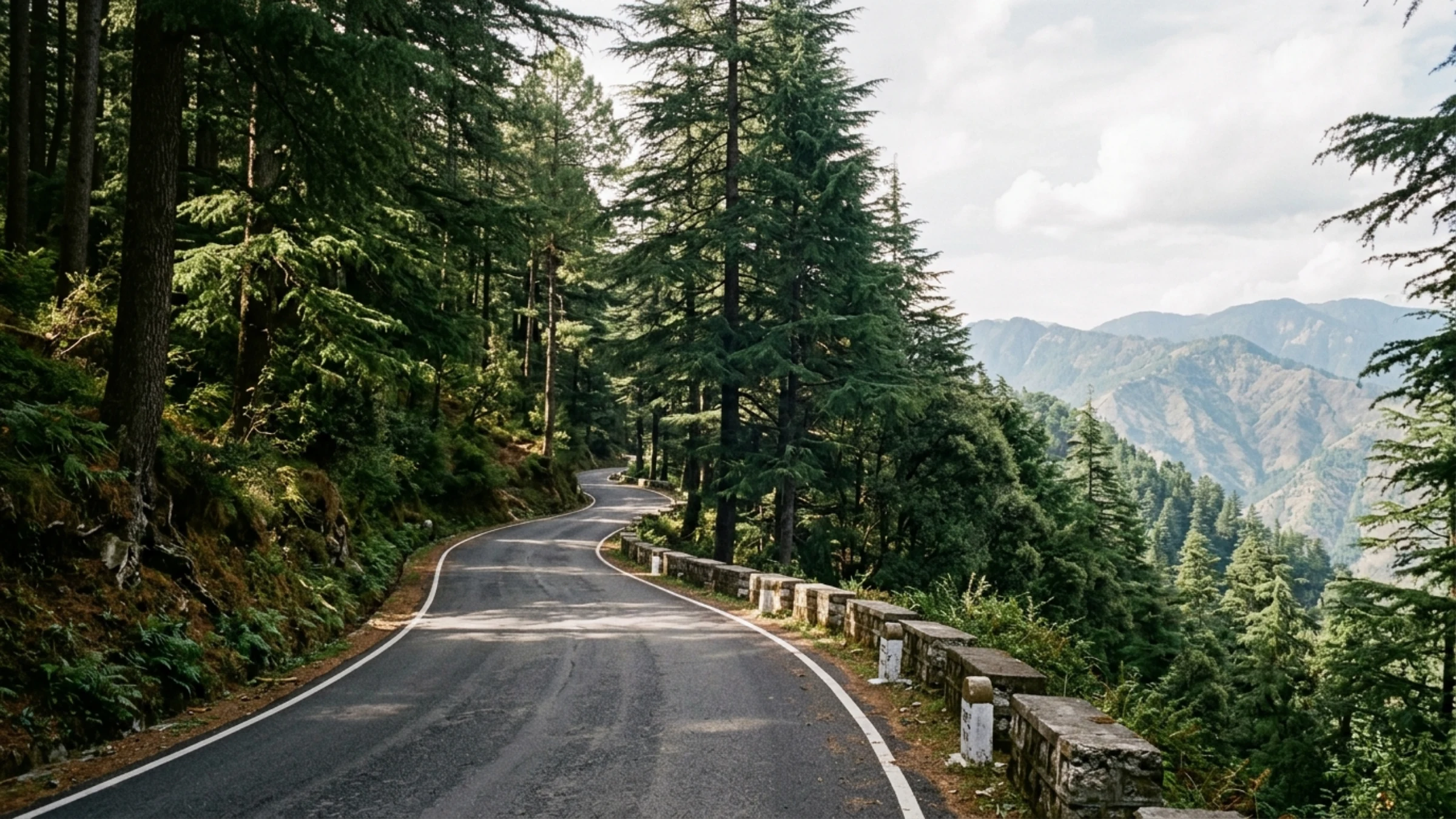
Direct Answer for Motorists: Driving from Delhi to Chail covers approximately 340 kilometers and typically takes between 7 and 8 hours under normal conditions, depending on starting point, traffic, and stops. The route follows National Highway 44 (NH44) north past Panipat and Ambala, connects with National Highway 5 (NH5) via the Himalayan Expressway near Parwanoo, and continues through Solan to Kandaghat. At Kandaghat, the Kandaghat–Sadhupul corridor is the more direct option when the priority is reaching Chail (~2,250 meters) without passing through Shimla and Kufri. An alternative route continues along NH5 past the Shimla outskirts and Kufri ridge (~385 km, approximately 9 to 10.5 hours), which is suitable primarily for travellers planning to visit Shimla before heading to Chail.
Delhi to Chail Road Trip: Quick Facts
| Travel Parameter | Route A: via Kandaghat & Sadhupul | Route B: via Shimla Outskirts & Kufri |
|---|---|---|
| Approximate Road Distance | Approx. 340 km from Central/North Delhi; approx. 375 km from Gurgaon via WPE | Approx. 385 km from Central/North Delhi |
| Estimated Driving Time | Approx. 7 to 8 hours (Delhi); approx. 7.5 to 8.5 hours (Gurgaon via WPE) | Approx. 9 to 10.5 hours (Delhi) |
| Highway Corridor | NH44 → NH5 (Himalayan Expressway) → Kandaghat → Sadhupul → Chail | NH44 → NH5 → Kandaghat → Shimla Outskirts → Kufri → Chail |
| Final Mountain Approach | Dedicated 29 km intermediate two-lane road from Kandaghat via Sadhupul | Mountain approach from Kandaghat via Shimla bypass and Kufri link road |
| Summit Elevation | Approx. 2,250 meters at Chail ridge | Approx. 2,510 meters at Kufri ridge before descending toward Chail |
| Traffic Characteristics | Bypasses the main Shimla and Kufri urban corridors | Passes commuter corridors around the Shimla outskirts and Dhalli |
| Road Surface Profile | Multi-lane national highway transitioning to paved two-lane mountain road | Multi-lane highway transitioning to hill bypass and narrower forest road |
| Winter Road Considerations | Lower-elevation valley approach; prioritized by local road maintenance | Higher elevation crossing at Kufri; greater potential for snow and ice |
| Fuel Planning | Fuel widely available on plains; top up at Kandaghat or Solan before ascent | Fuel available along NH5; top up before entering the narrower Kufri-Chail road |
| Stay Base Context | Chail Camps & Cottages (Verified Upvan Partner Stay with on-site parking) | Chail Camps & Cottages (Verified Upvan Partner Stay with on-site parking) |
Route Comparison: Kandaghat–Sadhupul vs. Shimla–Kufri
When driving from Delhi NCR to Chail, motorists encounter a primary route division at Kandaghat in Solan district. Choosing between these corridors depends on whether your priority is reaching Chail directly or incorporating stops around Shimla.
[DELHI NCR: Mukarba Chowk / WPE]
                                                 │
                                                 ▼ (NH44: approx. 200 km)
                                         [AMBALA CANTONMENT]
                                                 │
                                                 ▼ (NH5: approx. 65 km via Himalayan Expressway)
                                            [PARWANOO]
                                                 │
                                                 ▼ (NH5: approx. 45 km via Solan bypass)
                                            [KANDAGHAT] (~1,430 m)
                                                 │
                        ┌────────────────────────┴────────────────────────┐
                        ▼                                                 ▼
             [ROUTE A: DIRECT CORRIDOR]                        [ROUTE B: ALTERNATIVE]
            Via Sadhupul (Mountain Road)                      Via Shimla Bypass & Kufri
        ──────────────────────────────────                ──────────────────────────────────
        • Mountain segment: 29 km                         • Mountain segment: longer hill drive
        • Direct approach via Ashwani valley              • Climbs over Kufri ridge (~2,510 m)
        • Avoids Shimla urban corridor                    • Passes Shimla bypass & Dhalli area
        • Total trip: approx. 340 km                      • Total trip: approx. 385 km
        • Driving time: approx. 7–8 hours                 • Driving time: approx. 9–10.5 hours
Route A: The Kandaghat & Sadhupul Corridor
The Kandaghat–Sadhupul corridor is the more direct option when the priority is reaching Chail without passing through Shimla and Kufri.
At Kandaghat junction, vehicles turn right off NH5 onto a dedicated 29-kilometer mountain road descending to Sadhupul (~1,350 m), crossing the river bridge, and climbing through pine and oak slopes into Chail (~2,250 m).
- Avoids Shimla Traffic: Bypasses commuter corridors near Shoghi, Taradevi, and the Shimla suburban perimeter.
- Paved Surface: Intermediate two-lane asphalt road regularly navigated by standard passenger cars.
- Controlled Elevation: Valley approach stays below 2,300 meters, avoiding higher passes subject to prolonged winter frost.
- Maintenance: Prioritized by local public works divisions for routine upkeep and seasonal clearing.
Route B: The Shimla Outskirts & Kufri Ridge Alternative
Route B continues along NH5 toward Shimla, using the circular bypass through Dhalli to ascend Kufri ridge (~2,510 m), where a secondary road branches along the sanctuary border into Chail.
- Distance and Time: Adds approximately 45 kilometers and 1.5 to 2.5 hours of driving, totaling roughly 385 kilometers (9 to 10.5 hours).
- Transit Delays: Traverses suburban corridors that handle regional transport and slow during peak commuter hours.
- Higher Elevation: Crosses above 2,500 meters where shaded forest stretches retain snow and winter road frost longer.
- Suitability: Best suited for travellers whose plans specifically include sightseeing in Shimla or viewpoints around Kufri before continuing to Chail.
Route A Step-by-Step Highway Log: Delhi NCR to Chail
Dividing the drive into four segments helps drivers plan navigation, rest stops, and timing.
Leg 1: Delhi NCR to Ambala via NH44 (approx. 200 km / 3 to 3.5 hours)
Departing north Delhi via Mukarba Chowk, vehicles join NH44, a multi-lane expressway bypassing Panipat and Karnal with steady speeds.
- Toll Checkpoints: Electronic FASTag toll plazas operate near Murthal, Panipat, Bastara (Karnal), and Shambhu.
- Key Waypoints: Kundli, Sonipat, Murthal, Samalkha, Panipat, Gharaunda, Karnal, Kurukshetra, and Ambala Cantonment.
Leg 2: Ambala to Parwanoo via Himalayan Expressway (approx. 65 km / 1 hour 15 mins)
Near Ambala, traffic transitions onto NH5 toward Panchkula. Approaching the foothills, the Himalayan Expressway bypasses Pinjore and Kalka before entering Himachal Pradesh at Parwanoo (~600 m).
- Key Waypoints: Zirakpur, Panchkula, Pinjore bypass, Kalka bypass, and Parwanoo.
Leg 3: Parwanoo to Kandaghat via Solan Bypass (approx. 45 km / 1 hour 30 mins)
Beyond Parwanoo, NH5 winds through Solan as a four-lane hill highway with flyovers around Kumarhatti and Solan, plus a tunnel near Barog.
- Key Waypoints: Jabli, Dharampur (KM 285), Kumarhatti, Solan bypass, and Kandaghat junction (~1,430 m).
Leg 4: Kandaghat to Chail via Sadhupul (approx. 29 km / 50 to 65 mins)
At Kandaghat, vehicles turn onto the mountain road to Chail, adjusting speed to two-lane hill curves.
- Descent to Sadhupul (approx. 15 km): Road winds down from ~1,430 meters at Kandaghat to ~1,350 meters at the Ashwani river crossing at Sadhupul.
- Climb to Chail Ridge (approx. 14 km): Ascends through pine and oak woods, gaining roughly 900 meters to reach Chail bazaar (~2,250 m).
- Regional Context: For travellers exploring weekend driving itineraries across northern hill regions, browse our guide to weekend getaways from delhi to see how the Chail corridor compares with other destinations in Himachal Pradesh and Uttarakhand.
Route B Alternative: The Shimla Outskirts & Kufri Ridge
Travellers combining their trip with stops around Shimla can continue along NH5.
Continuing Past Kandaghat on NH5
Beyond Kandaghat, NH5 climbs past Shoghi and Taradevi as commuter traffic and freight converge toward Shimla.
Navigating the Shimla Bypass & Dhalli Area
To bypass central Shimla, vehicles take the circular route toward Dhalli tunnel. This corridor carries traffic into Upper Himachal and slows during peak hours and weekends.
The Kufri Ridge Ascent (~2,510 m) & Link Road to Chail
Beyond Dhalli, the road climbs to Kufri ridge (~2,510 m), where vehicles branch onto the Kufri-Chail road along the sanctuary boundary. This narrower forest road passes under deodar canopies, requiring caution when meeting oncoming vehicles.
Summary Comparison Table
| Route Feature | Route A: via Kandaghat & Sadhupul | Route B: via Shimla Bypass & Kufri |
|---|---|---|
| Approximate Distance (Delhi) | Approx. 340 km | Approx. 385 km (approx. +45 km) |
| Typical Driving Duration | Approx. 7 to 8 hours | Approx. 9 to 10.5 hours |
| Urban Corridor Exposure | Bypasses Shimla urban limits | Traverses Shimla bypass and Dhalli corridor |
| Highest Route Elevation | Approx. 2,250 meters (Chail) | Approx. 2,510 meters (Kufri ridge) |
| Winter Frost Exposure | Lower valley ascent; less prolonged shade | Dense northern shade; higher potential for road frost |
| Scenic Landscape | Terraced hillsides and Ashwani river valley | High-elevation ridge views and dense cedar woods |
| Road Width | Intermediate two-lane throughout | Four-lane highway transitioning to narrower forest road |
| Primary Suitability | Direct, unhurried travel to Chail | Combined travel visiting Shimla or Kufri first |
Delhi NCR Departure Planning
Because Delhi NCR covers an expansive area, your starting point determines the most efficient route to the northern corridor.
| Departure Zone | Recommended Connection Route | Estimated Distance & Time |
|---|---|---|
| Central/North Delhi (Connaught Place, Civil Lines, Rohini) |
Outer Ring Road → Mukarba Chowk → Singhu Border → NH44 | Approx. 335–340 km Approx. 7 to 8 hours |
| Gurgaon / Manesar (Cyber City, Golf Course Road, Sohna) |
NH48 → Western Peripheral Expressway (WPE/KMP) at Pachgaon → Kundli → NH44 | Approx. 370–375 km Approx. 7.5 to 8.5 hours |
| East NCR / Noida (Noida, Ghaziabad, Greater Noida) |
Eastern Peripheral Expressway (EPE) or Signature Bridge → NH44 | Approx. 355 km Approx. 7.5 to 8.5 hours |
Central and North Delhi Departures (Mukarba Chowk & Singhu)
Motorists in Central or North Delhi join NH44 directly via Outer Ring Road and Mukarba Chowk, crossing Singhu border. An early departure helps avoid suburban traffic before morning commercial activity begins.
Gurgaon & Manesar Departures (Western Peripheral Expressway)
For travellers in Gurgaon or Manesar, connecting to the Western Peripheral Expressway (WPE / KMP) at Pachgaon provides an access-controlled bypass around Delhi, joining NH44 at Kundli. While adding 30 to 35 kilometers (~375 km total), it avoids inner-city traffic.
General Departure Guidance
An early departure helps travellers clear Delhi NCR and reach the hills with daylight remaining. Clearing the plains by midday also ensures the final 29-kilometer mountain ascent from Kandaghat to Chail is driven in full daylight, which is particularly helpful for first-time mountain drivers.
Highway Stops Along NH44 and NH5
Breaking the drive at established roadside plazas helps maintain driver alertness and comfort.
1. Murthal (KM 50–55 on NH44, Sonipat District)
Located 50 kilometers north of Delhi, Murthal is a traditional breakfast stop on NH44. Complexes like *Amrik Sukhdev* and *Haveli* offer high-capacity dining, bakeries, and clean restrooms for early morning departures.
2. Karnal (KM 125–135 on NH44)
Around KM 125–135, the Karnal bypass offers pleasant rest stops. *Karnal Lake Oasis Complex* provides lakeside gardens and cafeteria dining, while nearby *Savoy Greens* offers familiar food outlets and fuel facilities.
3. Dharampur (KM 285 on NH5, Solan District)
At roughly 1,400 meters elevation in the Shivalik hills, Dharampur marks the transition to mountain dining. *Giani Da Dhaba* serves hearty North Indian meals, while roadside stalls offer seasonal Himachal fruits.
4. Sadhupul (KM 325 on Kandaghat-Chail Road)
Halfway along the 29-kilometer mountain approach, Sadhupul sits where the road crosses the Ashwani stream. Riverside kiosks offer tea and light snacks, providing a relaxing break before completing the climb to Chail.
Fuel Planning Before the Mountain Approach
Planning fuel and charging before leaving the national highway network avoids inconvenience in the hills.
Highway Corridor Fuel Density
Fuel stations are plentiful along NH44 and NH5, with major brands every few kilometers offering digital payments and air checks.
Fuel Considerations on the Mountain Road
Fuel options decrease sharply after leaving NH5. Chail has limited retail fuel infrastructure, typically a single pump with variable operating hours that should not be relied upon on arrival. A sensible practice is topping up at Kandaghat junction or along the Solan bypass before the 29-kilometer mountain ascent, ensuring sufficient fuel for local sightseeing and the descent.
Electric Vehicle (EV) Travel Considerations
Driving an EV from Delhi to Chail requires planned charging intervals:
- Highway Fast Chargers: Public fast-charging stations operate along NH44 (Murthal, Karnal, Ambala) and approaching Chandigarh/Zirakpur.
- Elevation Battery Consumption: Climbing from Kandaghat (~1,430 m) to Chail (~2,250 m) increases battery consumption substantially compared to flat highways. Enter the hills with ample reserve.
- Accommodation Charging: EV drivers should confirm in advance whether standard slow-charging plug points are accessible on site, rather than expecting dedicated chargers.
FASTag Toll Logistics
All toll plazas along NH44 and the Himalayan Expressway operate under electronic FASTag collection. Check current toll rates before departure, as rates are subject to periodic NHAI revisions, and ensure your linked account carries sufficient balance to prevent boom barrier delays.
Scenic Detours Along the Route
For travellers interested in heritage, several diversions lie along NH5 between Parwanoo and Kandaghat.
1. Timber Trail Aerial Ropeway (Parwanoo)
Located on NH5 near Parwanoo, this cable car spans a steep river gorge to reach higher Shivalik ridges, offering panoramic valley views at the gateway to Himachal Pradesh.
2. Historic Barog Tunnel 33 (UNESCO Kalka-Shimla Railway)
A short diversion from Kumarhatti leads to Barog. Constructed in 1903, Tunnel 33 is the longest straight tunnel on the narrow-gauge railway. The station features colonial wooden architecture and quiet mountain platforms. Drivers can park in upper village spaces and walk down.
3. Dagshai Cantonment
Branching eastward from Kumarhatti along a quiet forested ridge, Dagshai is a nineteenth-century cantonment town. It features historic church architecture, an old cellular jail museum, and peaceful pine walks.
4. Sadhupul River Crossing
Located directly along the Kandaghat-Chail road at the Ashwani stream, this riverside spot requires no detour. It provides a scenic pause for fresh tea before the road climbs into higher pine forests.
Mountain Driving Considerations
Navigating the 29-kilometer mountain approach from Kandaghat to Chail requires techniques different from highway cruising.
Managing Speed and Vehicle Momentum
Mountain driving requires steady, measured inputs. Maintain a pace allowing a safe stop within the visible road ahead. On narrow stretches, give way to climbing vehicles needing continuous momentum.
Using Lower Gears on Descents
On descents—such as driving down from Chail to Kandaghat—avoid continuous foot braking, which overheats brake pads. Shift into a lower gear so engine compression controls descent speed, reserving brakes for corners.
Blind Curves and Overtaking Care
The road follows natural hillside contours with frequent blind turns:
- Horn Use: Use a gentle tap of the horn before entering blind corners during daytime to alert oncoming traffic.
- Overtaking Restraint: Never overtake on blind bends. Wait patiently for a clear, straight view of the opposing lane.
Monsoon Driving Precautions
During monsoon months (July–August), check official Himachal traffic advisories before departure. Avoid driving during torrential rain and aim to complete mountain stretches during daylight hours.
Winter Driving Considerations
Winter brings crisp mountain air and quiet forest trails to Chail, accompanied by distinct road conditions.
Episodic Snowfall Patterns
Snowfall in Chail is episodic rather than constant, occurring during winter weather systems between late December and early February. Sunny winter afternoons are crisp, while night temperatures drop sharply.
Elevation Differences: Kandaghat vs. Kufri
The two routes present very different winter driving profiles:
- Route A (via Kandaghat): Approaching Chail from a lower valley (~1,350 m at Sadhupul), snow accumulation is usually confined to upper ridges near Chail. Local road divisions actively maintain and clear this road.
- Route B (via Kufri): Traversing Kufri ridge above 2,510 meters, north-facing deodar forests block sunlight, allowing snow and packed ice to linger longer on the road surface.
Caution on Shaded Morning Surfaces
Sub-zero winter nights can create thin frost patches on shaded road sections that resemble ordinary damp asphalt. Exercise care on shaded north-facing corners and near hillside runoffs. Drive moderately and allow extra travel time.
Arriving in Chail: Stay Context & Lodging Base
Arriving in Chail brings an immediate transition into quiet pine and cedar surroundings. A compact crossroads bazaar connects to forested lanes leading toward palace estates, walking trails, and secluded ridges. For travellers planning their mountain itinerary, you can explore Chail destination stays and nature retreat options across the ridge.
Daylight Arrival Recommendation
Aiming to reach Chail before dusk allows you to complete the 29-kilometer mountain approach in daylight, enjoy valley views, and settle into your stay comfortably.
On-Site Parking Considerations
Dedicated on-site vehicle parking is particularly valuable in hill stations where roadside space is narrow. Choosing a property with private on-site parking ensures convenient vehicle access throughout your trip.
Verified Partner Stay: Chail Camps & Cottages
For road-trippers seeking comfortable lodging amidst pine woods, Chail Camps & Cottages serves as a convenient mountain base with dedicated vehicle parking and quiet forest cottages.
Operating as a verified partner property of Upvan Hotels & Resorts, this hillside stay features:
- Cottages & Alpine Tents: Independent forest cottages with valley balconies and alpine Swiss tents on terraced slopes.
- On-Site Parking: Dedicated private vehicle parking on property grounds away from town center congestion.
- Dining Facilities: In-house dining area serving freshly prepared meals for staying guests.
- Tranquil Setting: Situated in a peaceful environment sheltered beneath natural cedar and pine canopies.
To learn more about the surrounding hill station and seasonal travel planning, visit our companion guide on the unhurried guide to Chail’s pine forest trails and heritage.
Chail Camps & Cottages
Situated on quiet forested slopes near Chail, Chail Camps & Cottages provides on-site parking, comfortable wooden cottages with valley views, and alpine Swiss tents, serving as a restful base for self-drive travellers.
Frequently Asked Questions About Driving from Delhi to Chail
1. How far is Chail from Delhi, and how long does the drive take?
Driving from Delhi to Chail via NH44 and Kandaghat covers approximately 340 kilometers and takes 7 to 8 hours under normal conditions. From Gurgaon via WPE, it is roughly 375 kilometers (approx. 7.5 to 8.5 hours).
2. Which route from Delhi to Chail is the more direct option?
The Kandaghat–Sadhupul corridor (Route A) is the more direct option when heading straight to Chail (~45 km shorter than Route B), avoiding Shimla commuter traffic and providing a continuous 29-kilometer mountain ascent.
3. Are the mountain roads between Kandaghat and Chail suitable for standard passenger cars?
Yes. The 29-kilometer road from Kandaghat to Chail via Sadhupul is an asphalt-paved intermediate two-lane mountain road regularly navigated by standard passenger cars driven with ordinary care.
4. Where is it sensible to refuel before reaching Chail?
Top up your fuel tank to full capacity at Kandaghat junction or along the Solan bypass. Chail town has limited retail fuel infrastructure that should not be relied upon upon arrival.
5. What should electric vehicle (EV) drivers plan for on this route?
Public fast chargers operate along NH44 and approaching Chandigarh. Because the mountain ascent uses battery capacity faster, EV drivers should enter the hills with ample charge and confirm on-site slow charging in advance.
6. What are convenient highway stops for food and clean restrooms?
Murthal (KM 50–55 on NH44) offers breakfast stops like Amrik Sukhdev and Haveli. Near midway, Karnal Lake Oasis Complex (KM 125) and Savoy Greens (KM 135) provide clean amenities. At Dharampur (KM 285 on NH5), Giani Da Dhaba is an established meal stop.
7. How should drivers prepare for winter travel to Chail?
Snowfall is episodic between late December and early February. The Kandaghat route is actively maintained and generally more accessible in winter than Kufri (~2,510 m). Check local advisories and drive cautiously on morning frost.
8. Does Chail Camps & Cottages provide on-site parking for guest vehicles?
Yes. Chail Camps & Cottages provides dedicated private on-site parking on property grounds, ensuring secure space for guest vehicles away from town market congestion.
Commercial Travel Desk Card
Planning a road trip to Chail? Upvan Hotels & Resorts provides destination information, partner stay coordination, and seasonal route guidance.
- Stay Assistance:: Contact Upvan’s travel desk for room availability and reservation guidance at Chail Camps & Cottages.
- Route Planning:: Request current information on highway conditions and seasonal mountain driving advice.
Plan Your Mountain Retreat with Upvan
Experience handpicked mountain resorts, pine-sheltered cottages, and riverside sanctuaries across Himachal Pradesh, Uttarakhand, and near Delhi NCR. Enjoy verified hospitality, best direct rates, and personalized mountain itineraries.